

SpanSight can detect inbound vessels at a range of up to 20 nautical miles, enabling the detection of vessels exhibiting unusual behavior or on potential collision courses with vulnerable structures.
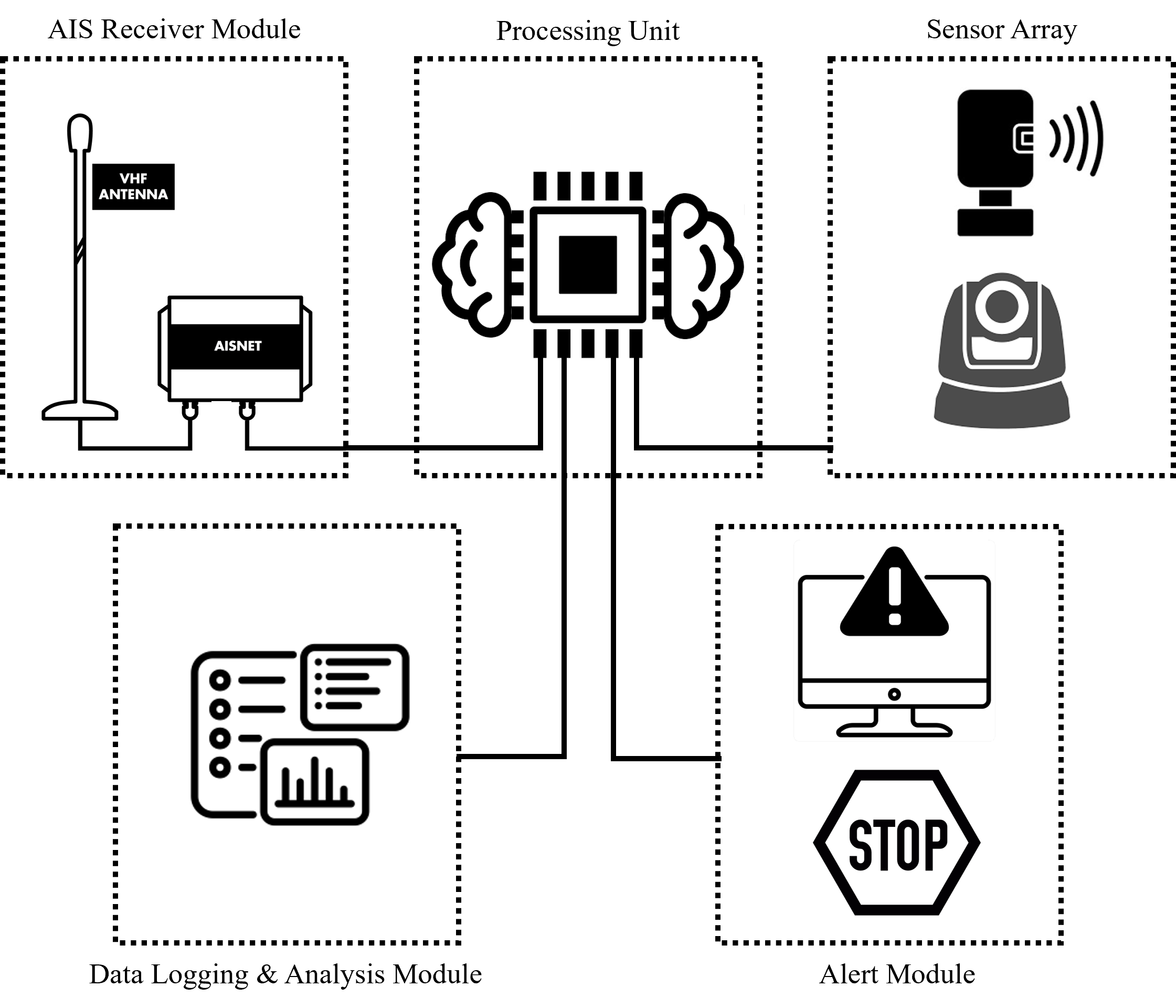
How it Works
SpanSight can be integrated into a multi-input, multi-response decision support system that supports both collision avoidance measures as well as traffic control to reduce potential loss of life in the event of a collapse. These features are implemented on a case-by-case basis, in consultation with the asset owner, the USCG, local pilots’ associations, and other relevant stakeholders.
AIS Data Capture
Tracks vessel identity, speed, course, and location.
Optical Cameras
Provide visual confirmation and documentation of incidents.
Artificial Intelligence
Processes sensor data to determine additional situational details.
When a vessel triggers predefined “alert criteria” the system triggers a real-time alert that includes:

Vessel ID and Technical Data

Visual Records of Incidents
